 vesseltracker.com
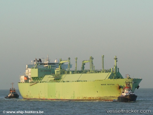
Vessel MARIGOLD LNG IMO: 9230062, MMSI: 538011391 Lng Tanker
UTC, 5.94119, 85.16228, course: 270, speed: 16.2
UTC, 5.94775, 84.39967, course: -1, speed: 16.2
2026-03-04 05:19:28 UTC, 5.92988, 83.97735, course: 268, speed: 16
Live AIS position:
UTC. 123 nm W of Abakaliki),
updated 2026-03-04 05:19:28 UTC.
Find the position of the vessel MARIGOLD LNG on the map. The latter are known coordinates and path.
marine traffic ship tracker show on live map
The current position of vessel MARIGOLD LNG is 5.92988 lat / 83.97735 lng. Updated: 2026-03-04 05:19:28 UTCCurrently sailing under the flag of Marshall Islands
Details:
Last coordinates of the vessel:
UTC, 5.94865, 85.36753, course: 266, speed: 16UTC, 5.94119, 85.16228, course: 270, speed: 16.2
UTC, 5.94775, 84.39967, course: -1, speed: 16.2
2026-03-04 05:19:28 UTC, 5.92988, 83.97735, course: 268, speed: 16